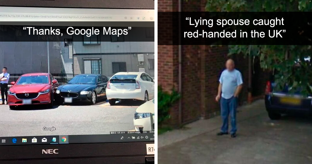
Google Maps is supposed to help us find the nearest coffee shop, avoid traffic, and prove to our friends that “left at the big tree” is not a valid navigation system. But every so often, it becomes something much stranger: a global treasure hunt where curious people zoom in and ask, “Wait… what exactly am I looking at?”
From mysterious figures on Street View to giant land art visible from satellite images, Google Maps has captured some truly odd moments. Some are funny. Some are beautiful. Some are optical illusions wearing a fake mustache. And a few make you wonder whether Earth is just one big weird scrapbook with GPS coordinates.
Below are 30 memorable examples of strange Google Maps and Google Street View finds that made people pause, zoom, rotate, zoom again, and possibly call someone over from the next room.
Why Google Maps Finds Feel So Addictive
The magic of Google Maps is scale. One second you are floating above the planet like a very nosy astronaut; the next, you are standing on a quiet street wondering why a person is wearing a horse mask. The platform mixes satellite imagery, Street View photography, user-submitted photos, historical images, and special collections captured by cars, backpacks, boats, camels, divers, and even dogs.
That variety creates the perfect recipe for odd discoveries. A shadow becomes a monster. A public art installation looks like alien engineering. A blurred face turns into a comedy moment. And because the images are real-world captures, even the silly ones feel more exciting than a staged meme. Google Maps weirdness works because it sits right between everyday life and “please explain this immediately.”
30 Odd Google Maps Moments That Made People Zoom In
1. The Horse-Headed Stranger in Aberdeen
One of the classic Street View mysteries is the “Horse Boy” of Aberdeen, Scotland: a person standing on an ordinary street while wearing a horse-head mask. It is the kind of image that looks like a prank, a folklore sighting, and a rejected album cover all at once.
2. The Pigeon People of Tokyo
In Japan, Street View once captured a group of people wearing pigeon masks. Instead of running away from the camera, they seemed prepared for it. The result became internet gold: part performance art, part neighborhood ambush, part “birds are getting organized.”
3. The Blurred Cow in Cambridge
Google’s automatic blurring protects faces and license plates, but sometimes the system gets hilariously polite. A cow by the River Cam in Cambridge appeared with its face blurred, as if it were entering witness protection after exposing a major hay scandal.
4. Loch Ness, Where Even Pegman Gets Dramatic
Loch Ness is already famous for monster legends, so Google Maps leaning into the myth feels appropriate. Street View imagery around the loch, including underwater and shoreline views, turned the area into a digital playground for anyone hoping to spot Nessieor at least enjoy the joke.
5. The International Space Station in Street View
Street View is not limited to streets, which is good news because the International Space Station has very few sidewalks. Users can explore parts of the ISS through Google’s special Street View collection, creating the odd feeling of floating through a space laboratory from a laptop.
6. A Camel Carrying the Street View Camera
To capture imagery in the Liwa Desert near Abu Dhabi, Google used a camel with Street View equipment. It was practical, low-impact, and visually unforgettable. Somewhere, a Street View car looked at that camel and thought, “I have been replaced.”
7. Dog View in Akita, Japan
Google Japan helped create “Pup View” in Odate City, using cameras attached to Akita dogs. The images show the world from a lower, fluffier perspective. It is Street View, but with more ears, snow, and emotional support.
8. The Great Barrier Reef Underwater
Google Maps has underwater imagery of coral reefs, including the Great Barrier Reef. Instead of streets and storefronts, users see sea turtles, coral, and blue water. It feels less like navigation and more like accidentally opening a portal in your browser.
9. The Grand Canyon Trekker Views
Google’s Street View Trekker helped capture the Grand Canyon on foot. The result lets users explore trails and dramatic canyon views without sweating through their shirt or pretending trail mix counts as lunch.
10. Hashima Island, Japan’s Eerie Abandoned World
Hashima Island, also known as Battleship Island, appears on Street View with crumbling concrete, empty buildings, and a haunting industrial atmosphere. It is not supernatural, but it certainly has “final level of a mystery game” energy.
11. The Nazca Lines in Peru
The Nazca Lines are ancient geoglyphs that look especially striking from above. On Google Maps and Google Earth, these massive figures and lines remind viewers that humans were creating zoom-worthy aerial art long before satellites were available to appreciate it.
12. The Badlands Guardian in Canada
The Badlands Guardian is a natural landform in Alberta that resembles a human head wearing a headdress when viewed from above. It is a powerful example of pareidolia, the human habit of seeing familiar shapes in random patterns.
13. Desert Breath in Egypt
Desert Breath is a huge spiral land art installation near El Gouna, Egypt. From above, it looks like a geometric signal carved into the desert. In reality, it is artbut yes, it absolutely has “ancient portal loading screen” vibes.
14. The Giant Pink Rabbit in Italy
On a hillside in Italy, the art collective Gelitin created a massive pink rabbit called “Hase.” Seen from satellite imagery, it looked wonderfully absurd: a giant soft toy dropped into the landscape as if the sky had a very unusual laundry accident.
15. The Shipwreck With Trees Growing Out of It
The SS Ayrfield in Homebush Bay, Australia, is a shipwreck that has become famous because vegetation grows from its rusting hull. From above, it looks like a floating forest that decided boats were better than soil.
16. Rows and Rows of Retired Aircraft
Satellite views of aircraft storage areas can look unreal: dozens or even hundreds of planes lined up in neat rows. From above, they resemble toys arranged by the world’s most organized child.
17. The Palm-Shaped Islands of Dubai
Dubai’s Palm Jumeirah is not odd because it is mysterious; it is odd because it is so deliberately bold. Zooming out reveals a giant palm tree made of land, roads, homes, and luxury planning that apparently began with, “What if real estate looked like a logo?”
18. The World Islands
Also near Dubai, the World Islands form a map-like pattern of artificial islands. From satellite view, the project looks like someone tried to copy Earth onto Earth, which is either genius or extremely committed doodling.
19. Bright Evaporation Ponds in the Desert
Potash evaporation ponds, such as those in Utah, create bright geometric pools that look digitally painted. Their blue and green shades stand out against desert landscapes, making them look more like modern art than industrial infrastructure.
20. A Plane Frozen in Mid-Flight
Sometimes satellite imagery captures an airplane in the sky. Because the image is static, the plane appears frozen over neighborhoods, fields, or water. It is not falling, parked, or hovering; it is simply caught between one second and the next.
21. Strange Ocean Lines That Are Not Secret Roads
People often find long lines across the ocean floor in map imagery and wonder whether they have discovered underwater highways. Usually, these are data artifacts from mapping methods. Still, the first impression can be delightfully dramatic.
22. Blurred Homes That Become Neighborhood Mysteries
Street View allows people to request additional blurring for privacy. The result can be a perfectly normal street where one house appears hidden behind a digital fog bank. Naturally, everyone wonders what happened there. Usually, the answer is simply privacy.
23. The Same Street in Different Years
Historical Street View lets users compare old and newer imagery. A business changes signs. A tree disappears. A childhood home gets repainted. It can feel like a tiny time machine, except the time machine has parking restrictions.
24. Empty Roads That Feel Like Movie Sets
Some Street View scenes show perfectly ordinary roads with no people, no cars, and dramatic lighting. The result is oddly cinematic, as if the map accidentally wandered into a quiet scene from a suspense movie.
25. Mascots and Costumes in Unexpected Places
Street View has captured people in costumes, masks, and festival outfits around the world. Most are harmless, but they become funny because Google Maps presents them without context. A person dressed as a character on a sidewalk becomes instant mythology.
26. Animals Staring Down the Camera
Dogs, cats, cows, birds, and curious wildlife occasionally appear in Street View. When they stare directly into the camera, it feels less like Google captured them and more like they captured Google.
27. Camera Glitches That Bend Reality
Street View stitches images together to create panoramic scenes. When movement, reflections, or timing confuse the stitching process, the results can stretch cars, duplicate people, or bend objects. It is not paranormal; it is just technology having a hiccup with confidence.
28. Giant Words Written on Land
From crop messages to hillside signs, satellite imagery often reveals words and symbols too large to fully appreciate from the ground. These discoveries are satisfying because they reward the exact behavior Google Maps encourages: zoom out, look closer, repeat.
29. Roads That Seem to Lead Nowhere
Remote deserts and rural areas sometimes show roads, tracks, or grids that appear to end in empty space. Many have practical explanationssurveying, utility access, mining, or old development plansbut they still look like secret levels on a world map.
30. Ordinary Moments Made Weird by the Camera
The oddest Google Maps captures are not always famous landmarks. Sometimes it is a person mowing a lawn, a dog mid-jump, a shadow at the wrong angle, or a delivery truck frozen in a funny position. The camera turns normal life into a puzzle, and the internet happily grabs a magnifying glass.
What These Google Maps Oddities Teach Us
These strange captures are not just internet snacks. They reveal how differently we see the world when we are given a bird’s-eye view, a street-level lens, and unlimited curiosity. Google Maps makes geography feel interactive. It also reminds us that Earth is full of visual surprises: ancient art, modern engineering, public jokes, accidental comedy, and landscapes that look designed by imagination itself.
There is also a privacy lesson tucked inside the fun. Street View blurring exists for a reason. Faces, license plates, homes, and sensitive details may be obscured to protect people. So while odd map finds are entertaining, the best way to enjoy them is with context, respect, and a healthy refusal to turn strangers into targets.
Experience Section: What It Feels Like to Hunt for Weird Google Maps Finds
Searching for odd Google Maps moments is a strangely relaxing hobby, mostly because there is no correct way to do it. You start with one placemaybe a famous lake, a desert, a tiny island, or the neighborhood where you grew upand five minutes later you are halfway across the planet inspecting a suspiciously perfect circle in the sand. It is the digital version of opening the fridge, forgetting what you wanted, and somehow learning about abandoned islands in Japan.
The best experience begins with curiosity rather than conspiracy. A strange shape is not automatically an alien landing pad. A blurred object is not automatically evidence of a secret. A warped person in Street View is usually a stitching glitch, not a new species of pedestrian. That is part of the fun. The first reaction is wonder; the second reaction should be investigation. Zoom out. Rotate. Check nearby roads. Compare satellite and Street View. Look at historical imagery when available. The explanation is often more interesting than the wild guess.
One enjoyable approach is to choose a theme. Search for land art, abandoned places, unusual islands, strange road patterns, or animal appearances in Street View. Another method is to follow geography: start at a coastline, trace rivers, move across mountain ranges, or explore deserts where large shapes stand out clearly from above. The planet becomes a puzzle board, and every zoom level offers a different kind of clue.
There is also a wonderful “human comedy” side to Street View. People wave at the camera. Animals investigate it. Someone wears a costume for no obvious reason. A quiet street becomes memorable because one tiny detail interrupts the expected scene. These moments feel charming because they are accidental. They are not polished advertisements or edited travel videos. They are slices of real life caught by a mapping system that was simply passing through.
At the same time, it is worth exploring responsibly. Avoid sharing private addresses in a way that embarrasses or exposes ordinary people. Do not assume the worst about blurred places or unusual objects. And remember that a map image is just one frozen moment, sometimes years old, sometimes distorted, and sometimes missing important context. Google Maps is a powerful tool, but it is not a crystal ball with Wi-Fi.
The real joy is not proving that you have found the strangest thing on Earth. It is realizing that the world is full of tiny surprises, and technology has given us a new way to notice them. Whether it is a giant pink rabbit on a mountain, a camel with a camera, a cow with blurred facial privacy, or a spiral carved into the desert, these odd captures remind us that exploration does not always require a passport. Sometimes all it takes is curiosity, a screen, and the courage to ask, “What on Earth is that?”
Conclusion
Google Maps began as a navigation tool, but it has become something bigger: a living archive of landscapes, streets, mistakes, jokes, mysteries, and accidental masterpieces. The strangest Google Maps captures are popular because they turn the familiar act of zooming into an adventure. One click can move you from your hometown to the ocean floor, from a quiet Scottish street to the International Space Station, or from a desert spiral to a dog’s-eye view of Japan.
The next time you open Google Maps, do not just search for directions. Wander a little. Zoom in on a coastline. Drop into Street View on a random road. Explore a landmark from above. You may not find a monster, a giant rabbit, or a privacy-protected cowbut then again, that is exactly what makes the search so fun.
Note: This article is written as original, publication-ready editorial content. The examples are based on documented Google Maps, Google Street View, Google Earth, public art, geography, and widely reported map discoveries, with private or sensitive details intentionally avoided.